Sold Status
$3,070,000 Sold Price
Land Type
3,565 Acres
Sold By LandVest, Inc-Burlington
Request a Showing or More Info

Call: 802-863-1500
Mortgage Provider
Mortgage Calculator
$
$ Taxes
$ Principal & Interest
$
This calculation is based on a rough estimate. Every person's situation is different. Be sure to consult with a mortgage advisor on your specific needs.
Washington County
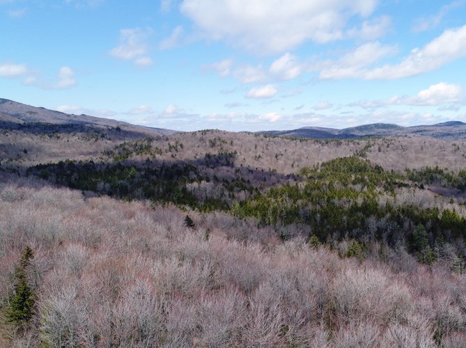
The 3,568-acre Eagle Ledge Timberland property represents a fully stocked timber investment asset that is dominated by mid-aged to maturing northern hardwoods with a mature softwood sub-component. Positive cash flow and steady asset appreciation will define this property as the overstocked stands are thinned in the coming decade. Easily accessible, the property is situated within 12 miles of Vermont’s state capital town of Montpelier with nearby markets for all products growing on the forest. The property’s conservation easement creates an asking price significantly below the land’s standing timber value ensuring timber growth will define future returns. The easement allows for development of three camps giving the land a solid recreational amenity. †
Property Location
Property Details
| Sold Price $3,070,000 | Sold Date Jun 15th, 2022 |
|---|---|
| MLS# 4726055 | Taxes $9,300 |
| List Price 3,270,000 | Exposure |
| Type Land | Surveyed No |
| Zoning Unknown | Road Frontage 5840 Ft |
| Lot Size 3565.0000 Acres | Water Frontage |
| Easements | Water Body |
| List Date Oct 31st, 2018 |
| MLS# 4726055 | Taxes $9,300 |
|---|---|
| List Price 3,270,000 | Exposure |
| Type Land | Surveyed No |
| Zoning Unknown | Road Frontage 5840 Ft |
| Lot Size 3565.0000 Acres | Water Frontage |
| Easements | Water Body |
| List Date Oct 31st, 2018 |
| Amenities |
|---|
| Topography Wooded, Stream, Conserved Land |
| Location |
| Utilities |
| Directions The property offers developed access at five landing points along Route 12, covering nearly all of the terrain sloping toward the river that runs along this paved road. In addition, an undeveloped right-of-way leading from Route 12 provides possible access to the extreme southern end of the land. |
| Current Use Timber | Roads Public, Paved, Dirt |
|---|---|
| Sewer On Site Septic Needed | Roads Public, Paved, Dirt |
| Water On Site Well Needed | Structure |
| Electric At Street | Shore Rights |
| Gas | Restrictions |

† The remarks published on this webpage originate from Listed By Michael Tragner of Fountains Land Inc. via the NNEREN IDX Program and do not represent the views and opinions of Coldwell Banker Hickok & Boardman. Coldwell Banker Hickok & Boardman Realty cannot be held responsible for possible violations of copyright resulting from the posting of any data from the NNEREN IDX Program.

 Back to Search Results


