Sold Status
$170,000 Sold Price
Land Type
24 Acres
Sold By
Similar Properties for Sale
Request a Showing or More Info

Call: 802-863-1500
Mortgage Provider
Mortgage Calculator
$
$ Taxes
$ Principal & Interest
$
This calculation is based on a rough estimate. Every person's situation is different. Be sure to consult with a mortgage advisor on your specific needs.
Washington County
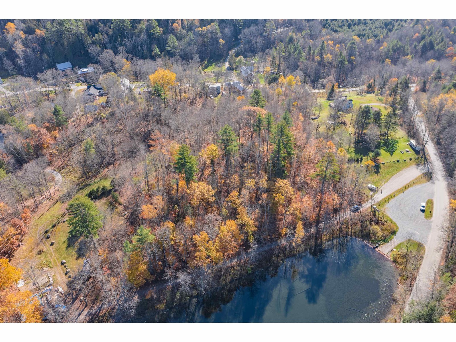
UNDER APPRAISED VALUE. Magnificent southwest views of Worcester Range and Camel's Hump. Easy rolling meadow edged by stone wall, tree lines and forest. Two headwater springs that feed Still Brook emergent in mixed woods on back of property. Running stream with potential for private pond. Near famed Unadilla Theatre, Bohmian Bakery, Grand View Winery. Excellent schools. Perfect solitude, spectacular views, cultured neighbors, local flavor - rare property for dreams to be built on. Offered by Central Vermont Real Estate. †
Property Location
Property Details
| Sold Price $170,000 | Sold Date Sep 19th, 2012 |
|---|---|
| MLS# 4149393 | Taxes $3,788 |
| List Price 179,000 | Exposure North, West, South |
| Type Land | Surveyed Yes |
| Zoning RR | Road Frontage 387 Ft |
| Lot Size 24.2000 Acres | Water Frontage |
| Easements | Water Body |
| List Date Apr 18th, 2012 |
| MLS# 4149393 | Taxes $3,788 |
|---|---|
| List Price 179,000 | Exposure North, West, South |
| Type Land | Surveyed Yes |
| Zoning RR | Road Frontage 387 Ft |
| Lot Size 24.2000 Acres | Water Frontage |
| Easements | Water Body |
| List Date Apr 18th, 2012 |
| Amenities |
|---|
| Topography Rural Setting, Mountain View, Country Setting, Farm, Fields, Rolling, View, Secluded, Pasture/Field, Pond Site, Horse Property, Stream, Walking Trails, Level, Open, Sloping |
| Location , Rural |
| Utilities |
| Directions From Montpelier exit 8 off I89 take Rte 2E (toward Plainfield) 6.8 miles. Left onto 14N at light, go 4.5 miles, Right on Max Gray (1.2 miles past Riverbend Store). Property 2.4 miles up Max Gray on right, situated between log cabin and small fenced settlers cemetery. |
| Current Use Horse/Animal Farm, Recreational | Roads Public, Gravel |
|---|---|
| Sewer On Site Septic Needed | Roads Public, Gravel |
| Water Spring, On Site Well Needed | Structure |
| Electric At Street | Shore Rights |
| Gas None | Restrictions |

† The remarks published on this webpage originate from Listed By of Central Vermont Real Estate via the NNEREN IDX Program and do not represent the views and opinions of Coldwell Banker Hickok & Boardman. Coldwell Banker Hickok & Boardman Realty cannot be held responsible for possible violations of copyright resulting from the posting of any data from the NNEREN IDX Program.

 Back to Search Results


