Sold Status
$76,500 Sold Price
Land Type
85 Acres
Sold By
Similar Properties for Sale
Request a Showing or More Info

Call: 802-863-1500
Mortgage Provider
Mortgage Calculator
$
$ Taxes
$ Principal & Interest
$
This calculation is based on a rough estimate. Every person's situation is different. Be sure to consult with a mortgage advisor on your specific needs.
Lamoille County
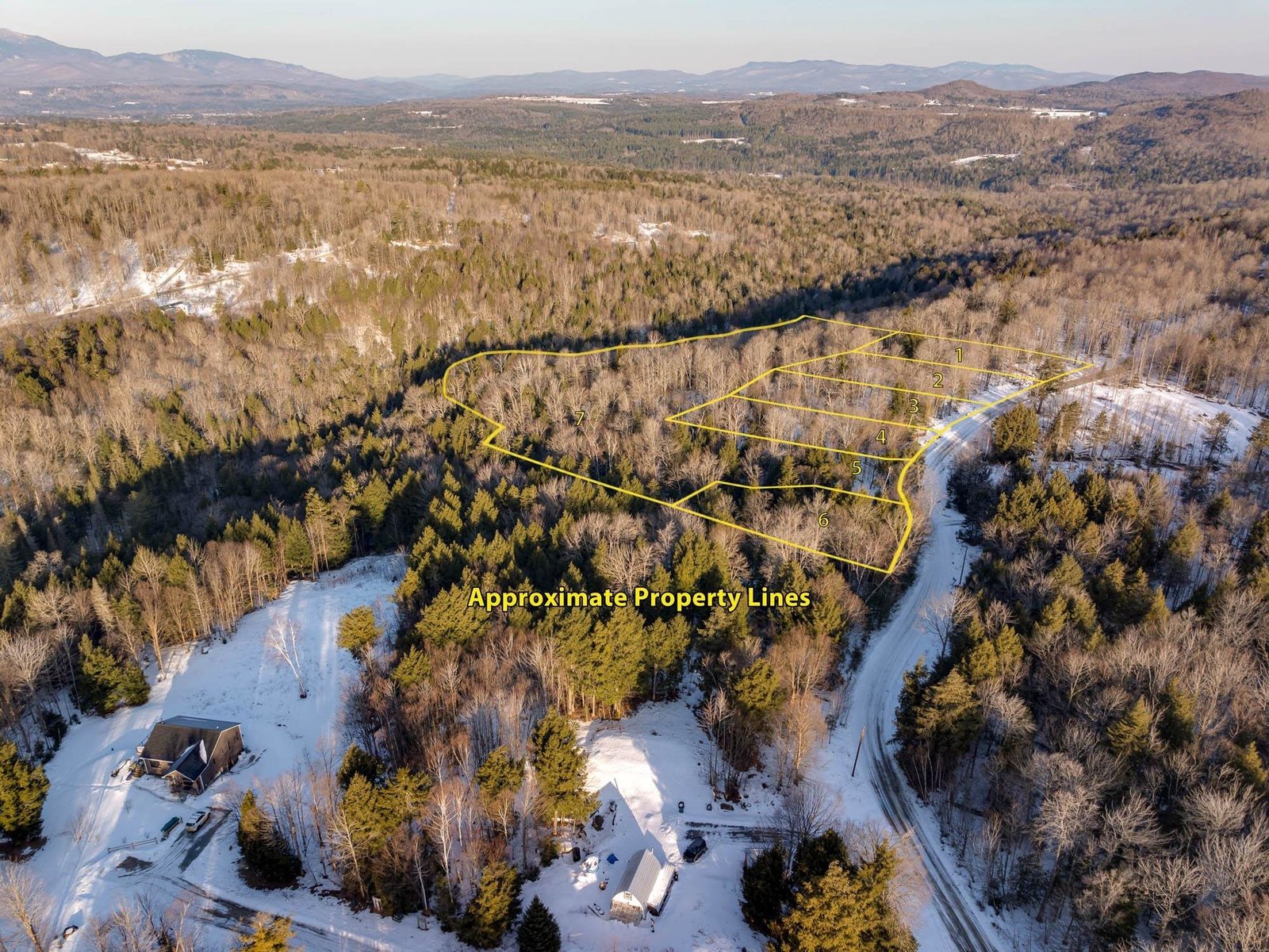
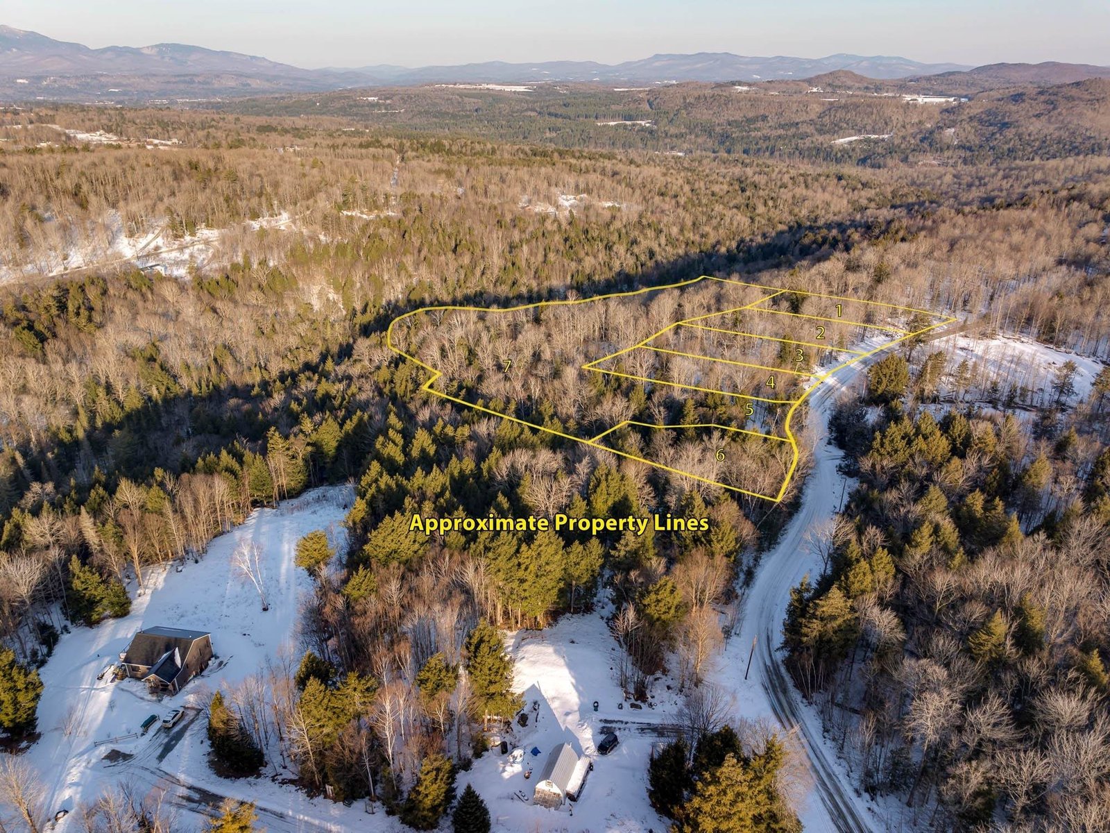
85 acres of mostly mature forest land. 74 acres are in Vermont Land Use Program. An 11 acre section is NOT in the Land Use Program. Attached is Land Use Orthographic photo showing about 13 acres in softwoods, 50 acres in hardwood and 10 acres in hemlock & yellow birch. Still be determined how much sugar maple in the 50 Acre parcel. On the 11 ac. section is open area from 12 year old log landing with very sound driveway already cut. Power is at roads edge. Buyer will either have to leave property in Land Use or pay the tax due. †
Property Location
Property Details
| Sold Price $76,500 | Sold Date Aug 3rd, 2015 |
|---|---|
| MLS# 4335947 | Taxes $3,015 |
| List Price 102,000 | Exposure East, South |
| Type Land | Surveyed Yes |
| Zoning Res | Road Frontage 1650 Ft |
| Lot Size 85.0000 Acres | Water Frontage |
| Easements | Water Body |
| List Date Feb 5th, 2014 |
| MLS# 4335947 | Taxes $3,015 |
|---|---|
| List Price 102,000 | Exposure East, South |
| Type Land | Surveyed Yes |
| Zoning Res | Road Frontage 1650 Ft |
| Lot Size 85.0000 Acres | Water Frontage |
| Easements | Water Body |
| List Date Feb 5th, 2014 |
| Amenities |
|---|
| Topography Slight |
| Location No, Rural |
| Utilities |
| Directions Take Marsh Road off Route 15 at the Wolcott-Hardwick Town line and proceed up hill about 1 mile on the left. South boundary is just North of 2246 Marsh Rd. mail box and across from 2217 Marsh Rd. driveway. North boundary is flagged and about across from Pole #20 on 45 degree angle uphill. |
| Current Use Timber | Roads Public, Gravel |
|---|---|
| Sewer None | Roads Public, Gravel |
| Water None | Structure None |
| Electric At Street | Shore Rights |
| Gas None | Restrictions |

† The remarks published on this webpage originate from Listed By Ken Libby of via the NNEREN IDX Program and do not represent the views and opinions of Coldwell Banker Hickok & Boardman. Coldwell Banker Hickok & Boardman Realty cannot be held responsible for possible violations of copyright resulting from the posting of any data from the NNEREN IDX Program.

 Back to Search Results